Back لاو (نهر إيطالي) Arabic نهر لاو ARZ Riu Lao Catalan Lao (Fluss) German Lao (rivero) Esperanto Río Lao Spanish Lao jõgi Estonian Lao (rijeka) Croatian Lao (folyó) Hungarian Lao (fiume) Italian
| Lao Mercure | |
|---|---|
 | |
 | |
| Location | |
| Country | Italy |
| Physical characteristics | |
| Source | Serra del Prete |
| • location | Pollino massif, Basilicata |
| • coordinates | 39°58′13″N 16°8′42″E / 39.97028°N 16.14500°E |
| • elevation | 2,181 m (7,156 ft) |
| Mouth | Tyrrhenian Sea |
• location | Scalea, Calabria |
• coordinates | 39°46′36″N 15°47′39″E / 39.77667°N 15.79417°E |
• elevation | 0 m (0 ft) |
| Length | 51 km (32 mi) |
| Basin size | 594 km2 (229 sq mi) |
| Discharge | |
| • average | 12.1 m3/s (430 cu ft/s) |

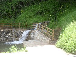
The Lao (Greek: Λᾶος; Latin: Laus, Laos or Laüs; formerly also Laino) is a river in southern Italy. It rises in the Lucanian Apennines in Basilicata (where it is known as the Mercure) and drains into the Tyrrhenian Sea near Scalea in Calabria.